Hydrogeological Survey & Borehole Siting in Kenya

Our Hydrogeological Survey Services
A hydrogeological survey is a scientific investigation of the subsurface rock layers beneath a site to determine whether groundwater is present, how deep it lies, how much can be sustainably extracted, and the most productive point to drill. Rather than guessing where to sink a borehole, a team of qualified, trusted hydrogeologists use geophysical methods to map what is happening tens or hundreds of meters underground, long before a drilling rig ever arrives on site. The survey also functions as the technical foundation for everything that follows on a project: it informs the drilling method the crew will use, the casing specification needed for the rock formation encountered, the pump size that will later be installed, and the abstraction volume documented in your WRA permit application. In that sense, this service isn't just a preliminary step, it's the blueprint the rest of the project is built around, which is why we treat borehole siting as a distinct discipline rather than an afterthought bundled loosely into drilling.
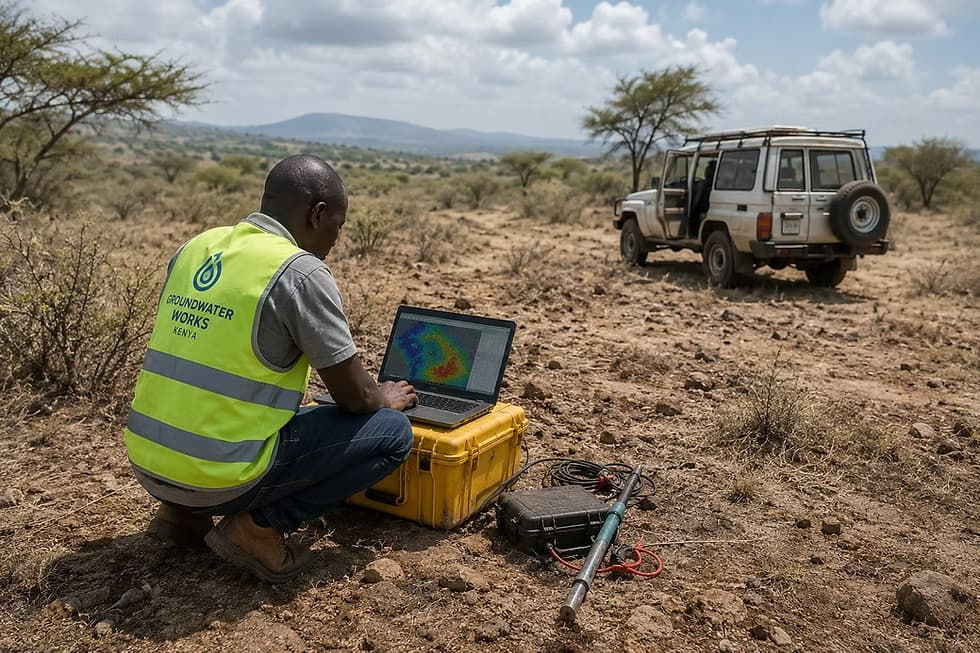
Geological Formations in Kenya
Kenya's geology varies enormously by region, which is precisely why a site-specific survey matters more here than it might in a geologically uniform country. The Rift Valley and surrounding volcanic regions often feature layered basalts, tuffs, and volcanic ash. Water-bearing potential varies with fracture density, so two properties a short distance apart can have very different prospects. Coastal areas frequently sit on sedimentary formations including sandstones and limestones that can host productive shallow aquifers, though saline intrusion is a genuine risk close to the ocean that a groundwater consultant Kenya clients hire should always assess as part of the survey. Central Kenya's basement complex rock formations tend to store water in fractured zones rather than uniformly throughout the rock mass, meaning yield can vary dramatically between two points just meters apart. Arid and semi-arid counties such as Kitui, Kajiado, and Machakos often require deeper drilling to reach reliable aquifers, but properly surveyed sites in these areas can still produce excellent yields. This regional variability is the core reason we never recommend skipping the survey, regardless of what a neighboring borehole achieved.

Typical Timelines
A standard hydrogeological survey, from the initial site visit to delivery of the final written report, typically takes three to seven working days depending on property size and how many VES points are required for a confident recommendation. Smaller residential plots with straightforward geology can sometimes be surveyed and reported on the faster end of that range, while larger agricultural parcels or sites with conflicting resistivity data may need additional survey points and correspondingly more analysis time. We always prioritize accuracy over speed on this stage of a project, since a rushed survey defeats the entire purpose of doing one in the first place.
Costs
Survey costs in Kenya vary based on property size, terrain accessibility, and the number of VES points needed to reach a confident conclusion, but clients should expect a modest, fixed professional fee that represents a small fraction of the cost of drilling a borehole in the wrong place. We provide a clear quote before any work begins, with no hidden charges added partway through the process. The survey fee is entirely separate from drilling, casing, and pump installation costs, which are quoted once the survey confirms a viable drilling point and we understand the depth and yield involved.
WRA Requirements
The Water Resources Authority requires a certified hydrogeological survey report as a core part of any borehole permit Kenya application, alongside a NEMA Environmental Impact Assessment for most projects. The WRA permit process reviews the recommended depth, expected yield, and proximity to other water sources to ensure sustainable groundwater use in the area, rather than simply rubber-stamping a proposed abstraction volume. Our reports are prepared to meet WRA permit documentation standards directly, and our licensed hydrogeologists provide independent certification of survey findings, which is often required for WRA submissions to be accepted without delay or requests for additional information.
Common Mistakes
The most common and costly mistake we see is landowners choosing a drilling point based on where a neighbor struck water, without accounting for how much local geology can change over relatively short distances, particularly in fractured basement complex rock where yield can vary sharply within meters. Another frequent error is skipping the survey altogether to save on upfront costs, only to face a dry hole and a second full drilling cost later, which almost always ends up more expensive than the survey would have been. Some property owners also attempt to proceed with drilling before their WRA permit Kenya application is approved, which can result in fines or forced capping of an unauthorized borehole. Finally, using an unqualified or unlicensed hydrogeologist Kenya operator can produce a technically weak report that the WRA rejects or questions, delaying the entire project.
Deliverables
At the end of the survey, clients receive a full written hydrogeological report identifying the recommended drilling coordinates, target depth, expected aquifer characteristics, and an estimated sustainable yield, all presented in a format ready for WRA and NEMA submission. This report includes the hydrogeologist's professional certification, which is frequently a specific requirement for permit approval rather than a nice-to-have addition. We also provide a plain-language summary explaining the findings in terms a non-specialist can follow, so clients understand exactly what to expect once drilling begins, including guidance on borehole test pumping and water yield testing once the borehole is complete.
Frequently Asked Questions
Does every borehole require a survey?
Yes, both as a practical safeguard against drilling a dry hole and because the WRA will not approve a permit without one, regardless of project size.
Can I use an old survey from a neighboring property?
No, groundwater conditions can change significantly within short distances, so a site-specific groundwater survey is always required.
What happens if the survey finds no viable aquifer at the preferred location?
We will advise honestly if a site is unlikely to produce a good yield, and can recommend alternative locations on the same property where geology may be more favorable.
Do you help with the WRA permit Kenya paperwork?
Yes, our reports are formatted for direct submission, and we can guide you through the full borehole permit Kenya process from survey through drilling approval.
How does this connect to later services like borehole maintenance or solar borehole pump installation?
A thorough survey gives us the yield data needed to correctly size a solar borehole pump system from the outset and establishes a baseline for future borehole maintenance and water yield testing.
See our
Learn More
If you're planning a borehole, these guides may help: